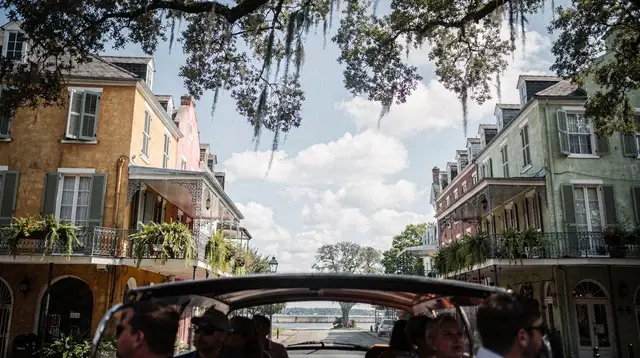
Accessible New Orleans: Planning Around Real Physical Obstacles
Is New Orleans easy to get around for visitors with mobility limitations?
It is workable but requires planning: the French Quarter's sidewalks are old and uneven, parking is scarce and strictly enforced, and distances between neighbourhoods are impractical on foot. Streetcars, rideshare and vehicle-based tours cover most of the gap, but St Louis Cemetery No. 1 can only be visited with an authorised guide, and summer heat and humidity are a separate obstacle in their own right.
Planning around terrain, distance and heat, not attractions
Most guides to New Orleans describe what to see. This one is about what it physically takes to get there and stand in front of it. New Orleans is flat, which helps, but flat is not the same as smooth, and compact is not the same as walkable for everyone. The obstacles that matter here are uneven sidewalks, difficult parking, distances that look short on a map but are not short on foot, one specific rule about a major cemetery, and a summer climate that is an accessibility issue in its own right. None of this is meant to discourage a visit. It is meant to replace assumptions with the specifics needed to plan one.
The French Quarter: compact, but not smooth
The French Quarter is often described as easy to explore because it is small — roughly thirteen blocks by six, laid out in a simple grid. That description is accurate for distance and misleading for surface. Much of the Quarter’s paving dates back well over a century: brick sidewalks, flagstone, and patched concrete slabs that shift with the soft, low-lying ground beneath them.
Curb cuts are narrow or missing on some corners, tree roots lift sections of pavement, and heavy rain — common for much of the year — leaves standing water in low spots that do not drain quickly. None of this is dangerous in the way traffic is dangerous, but it is the kind of terrain that turns a short block into slow, careful progress for anyone using a wheelchair, a walker, or simply managing joint or balance limitations.
The practical response is not to avoid the Quarter but to plan routes rather than wander them. Royal Street and the blocks immediately around Jackson Square tend to be in better repair than side streets further from the main tourist flow. Building in extra time between stops, rather than estimating walking time by block count alone, avoids the trap of a schedule that assumes even ground.
Parking is scarce, metered, and strictly enforced
Anyone considering a rental car for the Quarter itself should know that parking there is genuinely difficult. Spaces are limited, meters are enforced closely, and towing for violations — including expired meters and restricted zones — is routine rather than occasional. This is a real obstacle for a visitor who needs to park close to a destination rather than walk several additional blocks from a garage.
The more workable pattern for most visitors is to park once, in a garage in the Central Business District or the Warehouse Arts District, and use other transport for the rest of a day in the Quarter or Garden District. A car remains useful, sometimes necessary, for the day trips covered elsewhere on this site — the plantations of the River Road, the swamp and bayou country, or Cajun Louisiana — since none of those are reachable by rail or transit. Inside the city itself, a parked car is often a liability rather than a convenience.
Distances between neighbourhoods: streetcar and rideshare over long walks
New Orleans reads on a map as a cluster of adjoining neighbourhoods, and in casual descriptions they often are described that way. In practice, the distance from the French Quarter to the Garden District along St Charles Avenue, or from the Quarter up to Mid-City and City Park, is well beyond a comfortable walk for most people, and certainly beyond one that should be attempted on uneven paving in summer heat.
The RTA streetcar network exists largely to solve this. The St Charles line — the oldest continuously operating street railway in the world — runs the length of the Garden District and Uptown, the Canal Street line connects downtown to Mid-City, the Riverfront line runs along the river, and the Rampart–St Claude line covers the edge of the Quarter and Marigny. A day pass covers unlimited rides across all of them, and boarding a streetcar is a far more reliable way to cover distance than estimating it on foot. Streetcars are not universally step-free, so checking accessibility for a specific line before relying on it is worth doing directly with the RTA rather than assuming.
Rideshare apps fill the remaining gap, particularly for routes the streetcar lines do not cover directly, or for anyone who prefers door-to-door transport over a fixed stop. Between the two, most of the city’s distances stop being a walking problem and become a scheduling one instead.
A structured city tour is a reasonable way to see the wider layout of New Orleans without relying on your own navigation or stamina for the connecting distances between stops.
a guided city tour that covers New Orleans’ main neighbourhoods by vehicleSt Louis Cemetery No. 1: guided access only, and what that means for planning
The cemeteries of New Orleans are one of the city’s most distinctive sights, with above-ground tombs built because of the high water table. St Louis Cemetery No. 1 — the oldest and best known, and the burial place of the historical Marie Laveau — is not open to independent visitors under any circumstances. Entry is permitted only as part of a group with an authorised guide, and this rule has been consistently enforced for years, not an occasional restriction.
For most visitors this is simply a logistics note. For anyone managing mobility limitations or pacing energy across a day, it changes the shape of a cemetery visit more directly: instead of arriving independently, at a chosen pace, on a chosen path, the visit becomes a fixed-time, fixed-group event, walked at a pace set by the tour rather than the individual. Some tour operators can accommodate specific needs if contacted directly in advance, but this should be confirmed with the operator rather than assumed. It is worth building this into a schedule as an appointment, with buffer time either side, rather than as a stop slotted between others.
Heat and humidity as an accessibility factor, not just a comfort one
New Orleans has a humid subtropical climate, and its summers — roughly June through September — combine high heat with humidity heavy enough to make temperatures feel considerably worse than the number on a forecast. This is not simply a comfort issue. Heat and humidity at that level increase fatigue, raise the physical cost of any walking that does happen, and can affect medical conditions and medications in ways that flat terrain and short distances do not offset. Afternoon thunderstorms are also a near-daily feature of summer, adding sudden downpours to whatever routing challenges the sidewalks already present.
Spring and autumn are markedly more comfortable, with lower humidity and milder temperatures, and are worth weighing seriously against summer’s calendar of festivals if physical comfort is a bigger priority than crowd size. Winter is mild on average but can turn genuinely cold for short stretches, which is a different but real planning factor for anyone sensitive to sudden temperature swings. Whatever the season, treating heat as a standalone factor — alongside terrain and distance, not folded into general sightseeing advice — leads to more realistic daily planning: shorter blocks of outdoor time, more frequent breaks indoors, and transport booked rather than assumed on foot.
Comparing the main ways to cover ground in the city
| Option | Covers | Terrain avoided | Practical note |
|---|---|---|---|
| Walking | Short, direct blocks | None | Best limited to well-maintained stretches near Jackson Square and Royal Street |
| RTA streetcar | Longer fixed routes (St Charles, Canal, Riverfront, Rampart–St Claude) | Long-distance walking | Day pass covers unlimited rides; check step access for a specific line in advance |
| Rideshare / taxi | Point-to-point, any distance | Both distance and uneven paving | Most flexible option; useful for routes streetcars do not cover |
| Guided vehicle tour | Multiple neighbourhoods in one outing | Navigation and standing/walking between sights | Useful for covering the wider city without relying on personal stamina for transitions |
| Rental car | Day trips outside the city | Long highway distances | Practical for the River Road, swamp tours and Cajun Country; a liability for parking inside the Quarter |
A pass that bundles several sights together can also reduce the number of separate arrivals, queues and short walks across a day, which is worth weighing for anyone pacing their energy carefully.
a multi-attraction pass that groups several New Orleans sights under one ticketBuilding a realistic day
A day built around these constraints tends to work better when it groups nearby, well-paved stops together rather than crossing the city repeatedly. Anchoring a morning in the well-trodden core of the French Quarter — Jackson Square, the Cabildo, the Presbytere — before using the streetcar or a rideshare for an afternoon in the Garden District avoids stacking multiple long walks into a single day. A vehicle-based tour is a reasonable way to see areas like Treme or Mid-City without needing to navigate or walk their full distances independently.
a shorter guided tour for visitors who want to see more of the city without a full day on footFor a broader overview that covers music and culture as well as the built city, a guided outing can also cover ground that would otherwise mean long stretches between stops on uneven streets.
a guided tour covering New Orleans’ history and culture without extended independent walkingDay trips outside the city — the plantations of the River Road, the swamp and bayou country south and west of New Orleans, or Baton Rouge upriver — are worth booking through an operator that includes hotel pick-up when a rental car is not a good fit, since none of these areas are reachable by rail or transit and all involve road distances well beyond the city itself.
What this means for a first visit
None of the obstacles described here rule out a visit to New Orleans; they simply mean the city rewards planning more than improvisation. The compact grid of the French Quarter is genuinely walkable in short stretches, but its paving is old and uneven rather than smooth. Distances to the Garden District or Mid-City are better covered by streetcar or rideshare than on foot.
Parking inside the Quarter is scarce and enforced, while a car remains useful for day trips outside the city. St Louis Cemetery No. 1 requires a guided group, which turns a flexible stop into a scheduled one. And the summer climate is a factor to plan around on its own terms, separate from questions of terrain or distance entirely. Building a trip around these specifics, rather than around the general assumption that a small, flat city is automatically an easy one, is what makes the difference in practice.
Frequently asked questions about accessibility in New Orleans
Are the French Quarter’s sidewalks wheelchair-friendly?
Not consistently. The Quarter is flat, but its sidewalks are old brick, flagstone and uneven concrete, with narrow curb cuts, tree roots, and standing water after rain. A compact grid does not mean a smooth one.
Can I drive and park near the sights I want to see?
Parking in the French Quarter is limited, metered and closely enforced, with towing for violations. Many visitors do better parking once in a garage in the Central Business District or Warehouse District and using other transport for the rest of the day.
How do people get between neighbourhoods that are too far to walk?
The RTA streetcar lines connect the Garden District, Canal Street and the riverfront, and a day pass covers unlimited rides. Rideshare apps are widely available and are the practical choice for longer or less accessible routes.
Can I visit St Louis Cemetery No. 1 independently?
No. Access is restricted to visitors accompanied by an authorised guide, with no independent entry permitted. This adds a fixed appointment and a guided pace to any visit, which matters for anyone managing energy or mobility limits.
Is the heat itself a barrier, separate from the terrain?
Yes. Summer combines high heat with heavy humidity, and the effect on stamina and heat tolerance is significant regardless of how flat or how far the route is. It should be planned for as its own obstacle, not folded into general sightseeing advice.
Is New Orleans flat, at least?
Largely yes; much of the city sits at or below sea level. Flat terrain removes hills as a concern, but it does not compensate for broken paving, high curbs or long unshaded blocks.
What about getting to attractions outside the city, like the plantations or swamp tours?
Everything beyond New Orleans is reached by road, either with an organised tour that includes hotel pick-up or with a rental car. There is no practical rail or transit alternative for these day trips.
Accessible New Orleans tours on GetYourGuide
Verified deep-linked GetYourGuide tours. Book through these links and we earn a small commission at no cost to you.
GetYourGuide does not provide a product photo for this activity — the image shows the meeting point, photographed by us.