The city that everything else in Louisiana leaves from
Most people who fly into Louisiana land at Louis Armstrong New Orleans International Airport, drop their bags somewhere near the French Quarter or the Garden District, and only then start thinking about plantations, swamps, or Cajun Country. That order is correct. New Orleans is not one stop among several — it is the base. The River Road plantations, the swamp and bayou tours, Acadiana around Lafayette, and the Mississippi Gulf Coast all sit within roughly a two-hour drive, and almost every organised tour to any of them departs from a hotel in central New Orleans and returns the same evening.
This page is about the city itself: how its neighbourhoods fit together, what a realistic pace looks like, and why it rewards a few unhurried days before you head out on day trips. For the excursions themselves, see river road plantations, bayou country, cajun country and the gulf coast.
It also helps to be clear about what New Orleans is not. It is not the capital of Louisiana — that is Baton Rouge, about 130 km upriver — and it is not a coastal city. It sits on a bend of the Mississippi River roughly 160 km from the Gulf of Mexico, wedged between the river and the large, brackish Lake Pontchartrain. Much of the city lies at or below sea level, protected by an extensive system of levees and pumps rather than by natural elevation. That geography is not a footnote: it shaped where each neighbourhood grew, why the highest, oldest ground became the French Quarter and Garden District, and why New Orleans has spent three centuries negotiating with water on every side.
The French Quarter: small, walkable, and the reason most people come
The Vieux Carré, as the French Quarter is properly called, is roughly 13 blocks by 6 — small enough to cross on foot in twenty minutes, and easily the most rewarding part of the city to explore without a plan. It is laid out on a grid around Jackson Square, facing St Louis Cathedral, the Cabildo and the Presbytère, three buildings that between them cover most of the city’s Spanish and French colonial history.
Royal Street runs parallel to the noise, lined with art galleries and antique dealers; Decatur Street and the French Market sit along the river side, and a queue for beignets at Café du Monde is one of the city’s small rituals rather than a chore. Bourbon Street, a few blocks over, is what most first-time visitors picture — bars, brass bands spilling onto the pavement, and a licence, unusual in the United States, to carry a plastic “go-cup” of alcohol on the street within the Quarter.
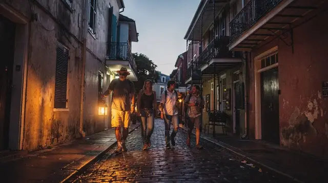
Because it is compact, the Quarter rewards walking far more than any guided transport, and a first morning spent wandering without a fixed itinerary is rarely wasted. For a structured route through it, see the French Quarter walking guide and the Jackson Square and St Louis Cathedral guide; for the neighbourhood’s ghost-story side, a well-run evening tour is one of the more atmospheric ways to see it after dark.
A walking tour through the Quarter’s haunted history after sunset covers many of the same streets from a different angle, and for something a little sharper, a adults-only tour mixing the Quarter’s ghost stories with its criminal past runs later in the evening.
Uptown, the Garden District and the streetcar line
Follow St Charles Avenue upriver from the Central Business District and the city changes register entirely. The Garden District and the adjoining Lower Garden District are lined with antebellum mansions set behind cast-iron fences and old live oaks, built in the nineteenth century by American merchants who settled just upriver from the older Creole city.
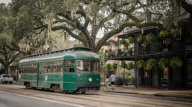
The St Charles streetcar, the oldest continuously operating street railway in the world, runs the length of the avenue and is as much a sightseeing ride as a way to get around — a slow, wooden-seated pass through the Garden District, Uptown and the university area near Tulane and Loyola. Lafayette Cemetery No. 1, a short walk off the avenue, is the most visited of the city’s above-ground cemeteries and a good introduction to the tomb architecture that appears across the city.
This part of town is quieter than the Quarter at night, which makes it a popular choice for a longer stay, and it pairs well with the streetcar as the main way to move between the two halves of the city. See the Garden District and the streetcar guide and getting around New Orleans by streetcar for routes and fares, and where to stay in New Orleans for how the Quarter and the Garden District compare as a base.
Tremé, the Marigny and Frenchmen Street
North of the Quarter, Tremé is one of the oldest African American neighbourhoods in the country and, by most accounts, the place where the music that became jazz first took shape, around Congo Square in what is now Louis Armstrong Park. It is a residential neighbourhood rather than a sightseeing district, best visited with some context rather than wandered blindly, and it is central to any honest account of the city’s culture. Downriver from the Quarter, the Faubourg Marigny and Bywater have a different, younger energy: Frenchmen Street, a few blocks of clubs and bars, is where locals send visitors who find Bourbon Street too loud and too touristy, with live jazz, brass bands and zydeco spilling out of small rooms most nights of the week.
Understanding the difference between these two strips — one built for visitors, one built for itself — changes how a lot of first-time visitors spend their evenings. See Tremé and the birth of jazz and Frenchmen Street vs Bourbon Street for the practical comparison, and note that live jazz here is not scheduled around tourists: Preservation Hall in the Quarter and the informal second-line parades that move through neighbourhood streets are both worth building an evening around rather than treating as a backdrop.
The cemeteries: New Orleans’ above-ground signature
Because so much of the city sits below sea level, the dead have traditionally been buried above ground, in tiered stone tombs rather than in the earth — a practical response to a high water table that has become one of the city’s most recognisable visual signatures. St Louis Cemetery No. 1, the oldest, holds the tomb traditionally associated with Marie Laveau, the nineteenth-century Voodoo Queen, a real historical figure rather than a legend invented for tourists; it can only be entered with an authorised guide, and an independent visit is not possible. Lafayette Cemetery No. 1, in the Garden District, has its own access arrangements, which change from time to time and are worth checking before a visit.
Both cemeteries sit close to routes covered elsewhere on this site, and both reward a guide who can separate documented history from the ghost-tour embellishments sold nightly around the Quarter. See the cemeteries of New Orleans visitor guide for what is currently open and how.
If the subject interests you beyond the cemeteries themselves, a guided walk through the Quarter’s ghost-themed history or a more classic French Quarter ghost tour told by a local guide both work as an evening activity that ties the cemeteries into the wider story of the neighbourhood.
A city below sea level
It is worth repeating, because it is easy to forget while wandering balconied streets: much of New Orleans sits at or below the level of the Mississippi River and Lake Pontchartrain around it, kept dry by an extensive system of levees, canals and pumping stations.
That engineering failed catastrophically on 29 August 2005, when Hurricane Katrina struck and the federal levee system gave way — not simply storm surge overwhelming the city, but a structural failure that flooded roughly 80% of New Orleans, hitting the Lower Ninth Ward, Lakeview and New Orleans East hardest. It remains a subject residents live with rather than a historical curiosity, and it is worth approaching with the seriousness it deserves rather than as a sightseeing spectacle; neighbourhoods where people rebuilt their lives are not a backdrop for tourism.
Practically, this geography also explains the hurricane season that runs from 1 June to 30 November, peaking statistically in late August and September. It is a risk to plan around rather than something that ruins most trips, and travel insurance is worth having for visits in those months.
Practical basics for staying in the city
New Orleans is easy to navigate without a car for as long as you stay within the city. Louis Armstrong International Airport (MSY) sits about 18 km west of the Quarter, roughly 25 to 40 minutes away by taxi, ride-hailing app or the RTA’s airport bus — there is no rail link. Once you are settled, the RTA’s streetcar lines and buses, helped by a day pass, cover most of what a first visit needs, and the French Quarter itself is best explored on foot. Parking in the Quarter is metered, limited and strictly enforced, which is one more reason a car is more useful for the day trips than for the city itself.
| Getting around | Best for |
|---|---|
| Walking | French Quarter, Marigny, Tremé edges |
| St Charles streetcar | Garden District, Uptown |
| Canal Street ferry | Algiers Point across the river |
| Ride-hailing apps | Late nights, Frenchmen Street, outer neighbourhoods |
| Rental car | Only once you start day trips out of the city |
Currency is the US dollar, sales tax is added at the till rather than shown in the price, and tipping — roughly 18–20% in restaurants and bars — is expected. For a first-time visitor working out what a realistic few days looks like, see how many days in New Orleans, new orleans for first-time visitors and a ready-made three-day itinerary; for the full range of things to do inside the city before you plan any excursion, see things to do in New Orleans.
Where the city hands you off to the rest of Louisiana
Once the French Quarter, Garden District and Tremé feel familiar, New Orleans becomes the base it is designed to be. Oak Alley, Laura and Whitney Plantations sit 45 minutes to an hour and a half upriver; the swamps and bayous around Jean Lafitte and Honey Island are 40 minutes to an hour away; Lafayette and Cajun Country are a little over two hours west; and the Mississippi Gulf Coast, with Biloxi and Gulfport’s beaches and casinos, is an hour to an hour and a half east. Almost none of this requires relocating — a hotel in New Orleans, a rental car or a booked tour with pick-up, and a day free, is usually all a day trip needs.
For the food and music vocabulary that will follow you the whole way through the region — gumbo, jambalaya, po’boys, and the difference between Creole and Cajun cooking — see Creole vs Cajun food explained, and for a first orientation to the plantation country and the swamps that make up most of those excursions, plantations along River Road compared and swamp tours compared: airboat vs boat are the natural next reads.
Frequently asked questions about basing yourself in New Orleans
Is New Orleans the capital of Louisiana?
No. Baton Rouge, roughly 130 km upriver, is the state capital. New Orleans is Louisiana’s largest city and its main tourist and cultural centre, but it has never been the seat of state government.
Is New Orleans on the coast?
No. The city sits on a bend of the Mississippi River, about 160 km upstream from the Gulf of Mexico, between the river and the brackish Lake Pontchartrain. The Gulf Coast beaches around Biloxi and Gulfport are a separate day trip east of the city.
How many days should I spend in New Orleans itself before day trips?
Most visitors need at least two full days for the French Quarter, Garden District, Tremé and Frenchmen Street before adding excursions. Three to five days in total, including one or two day trips, is a comfortable first visit.
Which New Orleans neighbourhood should I stay in?
The French Quarter puts you inside the walkable core but can be noisy at night; the Garden District and Uptown, linked by the St Charles streetcar, are quieter and still close. Both work well as a base for excursions elsewhere in Louisiana.
Can I visit the historic cemeteries on my own?
St Louis Cemetery No. 1 can only be entered with an authorised guide; an independent visit is not possible. Lafayette Cemetery No. 1, in the Garden District, has different access rules that can also change, so it is worth checking current conditions before you go.
Do I need a car to see New Orleans city itself?
No. The French Quarter is a compact, walkable grid, and the RTA streetcar and bus network, plus ride-hailing apps, cover the Garden District, Uptown, Tremé and Mid-City. A car becomes useful once you start leaving the city for plantations, swamps or the Gulf Coast.
Why is New Orleans below sea level?
Much of the city was built on drained wetland and river floodplain lower than the Mississippi and Lake Pontchartrain around it. Levees and a large pumping system keep it dry, a system that failed catastrophically when Hurricane Katrina struck on 29 August 2005.